Mobile GIS Solutions

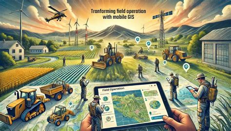
The integration of Geographic Information Systems (GIS) with mobile technology has revolutionized the way we collect, analyze, and disseminate spatial data. Mobile GIS solutions have become increasingly popular across various industries, including urban planning, natural resource management, and emergency response. The ability to access and manipulate GIS data in the field has enhanced the efficiency and accuracy of data collection, reduced costs, and improved decision-making processes. In this article, we will delve into the world of mobile GIS solutions, exploring their applications, benefits, and future directions.
Key Points
- Mobile GIS solutions enable efficient and accurate data collection in the field
- Integration with cloud-based services facilitates real-time data sharing and collaboration
- Mobile GIS applications support a range of industries, including urban planning, natural resource management, and emergency response
- Benefits of mobile GIS solutions include improved decision-making, reduced costs, and enhanced situational awareness
- Future developments in mobile GIS will focus on augmented reality, artificial intelligence, and Internet of Things (IoT) integration
Applications of Mobile GIS Solutions

Mobile GIS solutions have a wide range of applications across various industries. In urban planning, mobile GIS is used for asset management, transportation planning, and zoning enforcement. For instance, the city of New York uses mobile GIS to track and manage its assets, including buildings, roads, and utilities. In natural resource management, mobile GIS is employed for forest inventory, wildlife tracking, and environmental monitoring. The United States Forest Service, for example, uses mobile GIS to monitor forest health and detect early signs of disease outbreaks.
Emergency Response and Disaster Management
Mobile GIS solutions play a critical role in emergency response and disaster management. During emergencies, mobile GIS enables first responders to quickly assess situations, identify potential hazards, and develop effective response strategies. The Federal Emergency Management Agency (FEMA) uses mobile GIS to respond to natural disasters, such as hurricanes and wildfires. Mobile GIS also facilitates damage assessment, resource allocation, and situational awareness, ultimately saving lives and reducing economic losses.
| Industry | Mobile GIS Application |
|---|---|
| Urban Planning | Asset management, transportation planning, zoning enforcement |
| Natural Resource Management | Forest inventory, wildlife tracking, environmental monitoring |
| Emergency Response | Damage assessment, resource allocation, situational awareness |

Benefits of Mobile GIS Solutions

The benefits of mobile GIS solutions are numerous and well-documented. One of the primary advantages is the ability to collect and analyze data in real-time, enabling rapid decision-making and response. Mobile GIS solutions also facilitate collaboration and data sharing, reducing costs and improving situational awareness. Additionally, mobile GIS enables the use of location-based services, such as GPS and geofencing, to enhance data accuracy and precision.
Technical Specifications and Requirements
Mobile GIS solutions require a range of technical specifications and infrastructure to function effectively. These include mobile devices, such as smartphones and tablets, with adequate processing power, memory, and storage. Mobile GIS applications also require robust and reliable connectivity, including cellular networks and Wi-Fi. Furthermore, mobile GIS solutions must be compatible with various operating systems, including Android and iOS, and integrate seamlessly with existing GIS infrastructure and software.
What are the primary benefits of mobile GIS solutions?
+The primary benefits of mobile GIS solutions include improved decision-making, reduced costs, and enhanced situational awareness. Mobile GIS solutions also facilitate collaboration and data sharing, enabling rapid response and effective resource allocation.
What industries can benefit from mobile GIS solutions?
+Mobile GIS solutions can benefit a range of industries, including urban planning, natural resource management, emergency response, and environmental monitoring. Any industry that requires the collection, analysis, and dissemination of spatial data can benefit from mobile GIS solutions.
What are the future directions of mobile GIS solutions?
+The future directions of mobile GIS solutions will focus on augmented reality, artificial intelligence, and Internet of Things (IoT) integration. These technologies will enable the development of more sophisticated and interactive mobile GIS applications, enhancing the user experience and improving the accuracy and precision of spatial data collection and analysis.
In conclusion, mobile GIS solutions have revolutionized the way we collect, analyze, and disseminate spatial data. The benefits of mobile GIS solutions, including improved decision-making, reduced costs, and enhanced situational awareness, make them an essential tool for a range of industries. As mobile GIS technology continues to evolve, we can expect to see the development of more sophisticated and interactive applications, ultimately leading to better outcomes and improved decision-making.


